


Two undersea earthquakes struck Sumatra in Indonesia on Wednesday, August 19. They were followed hours later by the eruption of Mt. Sinabung in North Sumatra.

The first earthquake, a magnitude 6.8, hit 13.6 miles below the sea. The epicenter was located about 86 miles west-southwest of Bengkulu city on the western coast of Sumatra Island. It was followed by a magnitude 6.9 earthquake six minutes later, located 16 miles undersea and about eight miles away from the first.
Authorities said that the temblors posed no threat of a tsunami despite their relative strength and shallow location undersea. No injuries were reported and damage was said to be minimal.
Hours after the temblors, Sinabung erupted again after a series of eruptions during the past few weeks. The volcano is about 737 miles away from the city of Bengkulu. It's still unclear whether the eruption was triggered by the pair of quakes.
Two earthquakes hit Indonesia
Residents rushed outside their homes as the quakes rumbled through. They said that the earthquakes were short but strong. According to Bengkulu resident Jumentrio, "The first earthquake was quick...but another one hit shortly after and it was just as strong."
People were worried about the possibility of a tsunami due to the location of the quakes undersea and their relative strength and shallowness. Shallow quakes tend to be more destructive than deeper quakes. However, the Indian Ocean Tsunami Warning and Mitigation System said that they did not observe any threat of a tsunami to countries around the Indian Ocean.
There is currently no report on the damage caused by the quakes. But the United States Geologic Survey (USGS) said that there was a "low likelihood of casualties and damage."
According to the ASEAN Coordinating Center for Humanitarian Assistance (AHA), the two earthquakes may have been caused by the subduction of the Indo-Australian Plate under the Eurasian Plate. Indonesia sits near the boundary between the two plates, one of which moves under the other and sinks deep into Earth's layers. AHA said that this explanation is likely because of the location of the epicenters and the depth of the hypocenters.
The pair of temblors occurred after a magnitude 6.6 earthquake hit South Sumatra the previous day. It was located in almost the same area as the series of earthquakes that hit Indonesia in 2007. Experts suspected that this latest rumbler is an aftershock of it.
Earthquake-prone Indonesia
Indonesia is prone to catastrophic earthquakes that can generate a tsunami and further affect nearby countries.
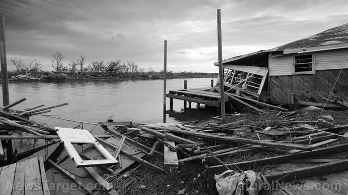
In December 2004, a magnitude 9.1 earthquake struck the west coast of Sumatra and killed nearly 230,000 people in different countries. The quake was located at about 18.5 miles undersea, generating massive tsunami along the coast of Indonesia as well as other countries around the Indian Ocean. Considered the third biggest earthquake in human history, it caused extensive damage amounting to 10 billion USD.
This deadly disaster was followed four months later by an 8.7 earthquake in 2005. This quake is only one-tenth as powerful as the 2004 quake, but is still considered the fourth largest earthquake in the last 100 years. Authorities recorded almost 1,000 fatalities.
The Java earthquake of 2006 also caused extensive damage and caused over 6,200 deaths. It was deemed unusual by experts who said that most earthquakes around Indonesia occur deep under Earth's surface. The magnitude 6.3 quake, however, occurred only about 12 miles below the ground. And although it was not accompanied by a tsunami, it was followed by an eruption of the Merapi volcano a few days later.
More recently, the Sulawesi earthquake of 2018 killed at least 844 people and left many people homeless. The 7.5 magnitude quake generated a tsunami and was trailed by many aftershocks. (Related: Surviving natural disasters: Earthquake and tsunami scenarios.)
Indonesia sits on the Pacific Ring of Fire – a region around the edges of the Pacific Ocean that spans Australia all the way to the Andes in South America. It estimated that 90 percent of all earthquakes occur in this region.
Learn more about earthquake-prone countries at Disaster.news.
Sources include:


Please contact us for more information.